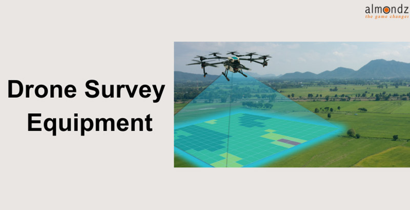
Drone Survey Equipment
Speed and Efficiency
Traditional surveying methods often require significant time and resources. Drones with advanced imaging technologies can swiftly capture high-resolution aerial images and videos of expansive areas. These images can then be stitched together to create detailed maps and 3D models, reducing survey time from days to hours.
Accuracy and Precision
Drone survey equipment boasts impressive accuracy levels, especially when integrated with specialized sensors like Global Navigation Satellite Systems (GNSS) and cameras with geotagging capabilities. These tools allow for precise measurements and georeferencing, enabling professionals to create accurate topographic maps and volume calculations.
Safety and Accessibility
In hazardous or hard-to-reach locations, drone surveys provide a safe alternative to manual inspections. Surveyors can collect data from a distance, eliminating the need to access dangerous sites. This is particularly beneficial for assessing infrastructure damage, monitoring remote ecosystems, or inspecting unstable terrain.
Applications of Drone Survey Equipment
Construction and Infrastructure Development
Drones have become indispensable in the construction industry. They facilitate site planning, progress tracking, and quality control. Aerial images captured by drones help project managers monitor construction phases, assess material stockpiles, and detect deviations from the original design.
Agriculture and Land Management
The agricultural sector has embraced drone technology for crop monitoring and management. Drones with multispectral cameras can assess plant health, identify nutrient deficiencies, and optimize irrigation. This data-driven approach enhances yield prediction and resource allocation.
Environmental Monitoring
Drones play a pivotal role in environmental conservation by providing real-time ecosystem data. They can monitor deforestation, track wildlife populations, and assess pollution levels. This information aids researchers and policymakers in making informed decisions to protect delicate ecosystems.
Archaeological Site Mapping
Archaeologists leverage drone surveys to capture high-resolution images of historical sites and landscapes. These images assist in creating detailed maps and 3D models, aiding archaeological research and preservation efforts. Visit Our Blogs and get
Mining and Resource Exploration
In the mining industry, drones are used for mapping terrain, monitoring stockpiles, and conducting safety inspections. Their ability to quickly access remote areas and collect data enhances exploration efficiency and minimizes human risk.
Choosing the Right Drone Survey Equipment
Payload Capacity and Sensor Compatibility
The choice of a drone depends on the intended application. Heavy-duty tasks, such as carrying LiDAR sensors for detailed terrain mapping, require drones with higher payload capacities.
Flight Time and Range
Longer flight times and extended ranges are crucial for covering larger areas. Professionals must consider battery life and signal range to ensure uninterrupted data collection.
Software and Data Processing
Practical data analysis relies on sophisticated software. Opt for drones that offer seamless integration with data processing tools to generate accurate and actionable insights. Regulations and Best Practices for Drone Surveys
FAA Guidelines and Airspace Restrictions
Drone operators must adhere to Federal Aviation Administration (FAA) regulations and respect airspace restrictions to ensure safe and legal operations.
Remote Pilot Certification
Pilots responsible for drone operations should obtain remote pilot certification, demonstrating their understanding of flight rules and safety procedures.
Data Privacy and Security
Drone surveys involve collecting sensitive data. Adhering to data privacy laws and implementing secure data storage practices is imperative.
Future Trends in Drone Survey Technology
LiDAR and Multispectral Imaging Integration
Integrating LiDAR and multispectral imaging promises enhanced data collection, allowing professionals to gather more detailed and accurate information.
Autonomous Navigation and AI-Powered Analysis
Advancements in autonomous navigation and AI-driven analysis enable drones to perform complex tasks independently, further streamlining survey operations.
Case Studies: Real-World Applications
Monitoring Crop Health and Yield
Agricultural drones with specialized cameras monitor crop health by analyzing plant stress levels and predicting yields.
3D Mapping of Construction Sites
Construction firms utilize drones to create detailed 3D maps, improving project planning and resource allocation.
Detecting Changes in Natural Habitats
Drones aid ecologists in tracking changes in wildlife habitats, contributing to conservation efforts.
Overcoming Challenges and Limitations
Weather Conditions and Flight Restrictions
Unfavorable weather conditions can hinder drone operations, emphasizing the need for flexible scheduling and contingency plans.
Data Interpretation and Integration
Translating raw drone data into actionable insights requires skilled professionals and robust data processing tools.
Conclusion
The advent of drone survey equipment has ushered in a new era of data collection, transforming industries across the board. Its remarkable speed, accuracy, and accessibility have empowered professionals to make informed decisions, streamline operations, and drive innovation. As drone technology continues to evolve, we can expect even more groundbreaking applications to shape the future of surveying and beyond.
Related Blogs
Road network survey vehicle
What is FWD Testing?
What is the Role of Infrastructure Advisory?