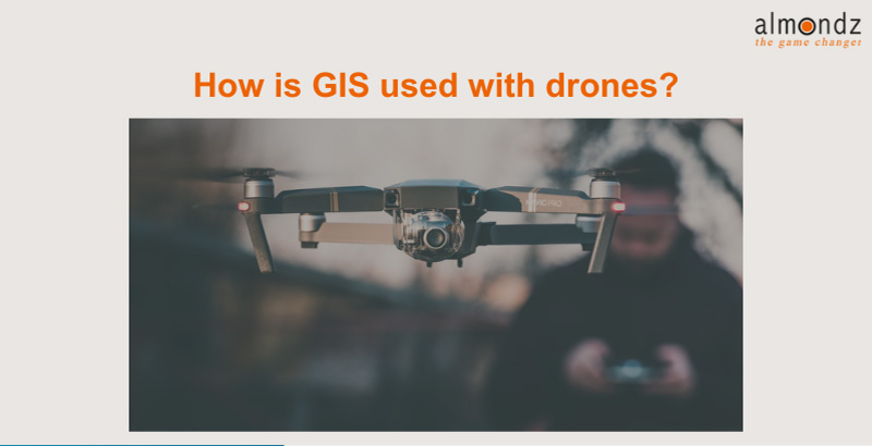
Geographic Information Systems (GIS) and drones have revolutionized how we collect, analyse, and utilize spatial data. GIS is a powerful tool that enables us to capture, manage, analyse, and present geospatial information, while drones, also known as Unmanned Aerial Vehicles (UAVs), have opened up new frontiers in data collection by providing high-resolution imagery and other sensor data from previously inaccessible or costly areas. The integration of GIS and drones has significantly enhanced our ability to understand and manage the world around us, significantly impacting various sectors such as agriculture, urban planning, environmental monitoring, disaster management, and more.
Data Acquisition
Data acquisition is one of the primary applications of drones in conjunction with GIS. Drones with various sensors, including cameras, LiDAR (Light Detection and Ranging), multispectral, and thermal sensors, can capture high-resolution imagery and geospatial data from above. This aerial perspective allows for collecting accurate and up-to-date information over large and complex areas, which would be challenging to achieve using traditional ground-based methods. The data collected by drones can be integrated into GIS Mapping platforms to create detailed and accurate maps, 3D models, and point clouds.
Precision Agriculture
Precision agriculture has greatly benefited from the integration of GIS and drones. Drones equipped with multispectral and thermal sensors can capture data highlighting variations in vegetation health, moisture content, and soil characteristics. By integrating this data into GIS software, farmers can create detailed maps that assist in optimizing irrigation, fertilization, and crop management practices. This targeted approach maximises yields and minimizes resource wastage, reducing environmental impact.
Environmental Monitoring and Conservation
The combination of GIS and drones has proven invaluable in environmental monitoring and conservation efforts. Drones with sensors can capture detailed information about ecosystems, water bodies, and wildlife habitats. This data aids researchers in tracking changes over time, identifying areas of concern, and implementing timely interventions. GIS software allows for integrating this data, enabling comprehensive spatial analysis that guides conservation strategies and policy decisions. Are you looking Drone Survey?
Infrastructure Planning and Management
Urban planning and infrastructure Advisory management benefit from the synergy between GIS and drones. Drones can swiftly capture aerial imagery and LiDAR data of urban areas, aiding in creating accurate 3D models. These models facilitate better decision-making regarding zoning, transportation planning, and infrastructure development. Planners can simulate potential scenarios by integrating drone-derived data into GIS platforms, analyze spatial relationships, and optimize resource allocation.
Disaster Management and Response
In disaster management, timely and accurate information is critical. Drones provide rapid assessment capabilities after natural disasters like earthquakes, floods, and wildfires. The collected data can be used to assess damage, identify affected areas, and plan emergency responses. By incorporating drone-captured data into GIS systems, emergency responders can prioritize areas for assistance, allocate resources effectively, and facilitate coordination among different agencies.
Challenges and Considerations
Despite the numerous advantages, integrating GIS and drones also comes with challenges. Data processing and management can be overwhelming, especially when dealing with large datasets drones generate. Ensuring data accuracy, addressing privacy concerns related to aerial imagery, and managing legal and regulatory frameworks are essential considerations when implementing drone-based GIS applications. Additionally, the initial investment in drones and GIS technology and the training required for personnel can be substantial.
Future Directions
The field of GIS and drone integration continues to evolve with technological advancements. Improvements in drone autonomy, battery life, and sensor capabilities are expanding the range of applications. Artificial intelligence and machine learning are being integrated into GIS platforms to automate the processing of drone-generated data, enabling more rapid analysis and decision-making. Collaboration between GIS professionals, drone operators, and domain experts is crucial for unlocking the full potential of this synergy.
Conclusion
Integrating Geographic Information Systems (GIS) with drones has ushered in a new spatial data collection, analysis, and decision-making era. Drones provide a unique vantage point for acquiring accurate and up-to-date geospatial information. At the same time, GIS technology enables the organization, analysis, and visualization of this data in meaningful ways. The combined power of GIS and drones has transformed various sectors, ranging from agriculture to disaster management, by providing previously unattainable insights. As technology advances, the potential applications of this integration are boundless, promising a future where we can better understand and manage our world.
Related Blogs
Drone Survey Equipment
How to Conduct a Road Survey: Step-by-Step Guide
Road network survey vehicle
Drone Survey Equipment: Revolutionizing Data Collection from Above
