What is drone survey
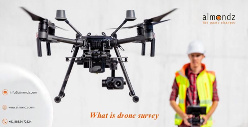
Once confined to the domain of enthusiasts and hobbyists, drones are becoming essential tools in many different businesses. Drone surveying is an innovative application that combines technology, efficiency, and precision to collect vital data for various uses.
What a Drone Survey Is
Drone survey involve gathering data from a specified region using uncrewed aerial vehicles (UAVs) fitted with specialized sensors. This approach has become popular because it may deliver precise, up-to-date data while lowering expenses and hazards related to conventional survey techniques.
Increasing Adoration throughout Diverse Sectors
Many sectors, including mining, construction, agriculture, and environmental monitoring, use drone surveys due to their efficiency and adaptability. This article explores the complexities of drone surveying, including its many advantages, drawbacks, and methods of operation.
Synopsis of Unmanned Aerial Systems
Sophisticated UAV technology, frequently including GPS, LiDAR, and high-resolution cameras, is necessary for drone surveying. These remotely controlled drones can traverse rugged terrain and thoroughly overview the investigated region.
Using Sensors to Compile Drone Survey Data
These drones' sensors are what make them magical. For example, LiDAR sensors can record fine-grained 3D images, and thermal cameras can detect temperature changes. Drone surveys are helpful in many industries because of this integration, which enables a more detailed awareness of the surroundings.
Advantages of Unmanned Aerial Vehicle Surveys
Economical
Drone surveys are more affordable than labor-intensive, traditional survey methods that require large machinery. Because of the much lower operating expenses, it's a compelling choice for companies trying to simplify their processes.
Efficient Use of Time
Large-scale surveys using drones can be completed in a fraction of the time compared to traditional survey crews. Drones' rapid data collection speeds allow organizations to make well-informed decisions quickly while saving time.
Enhanced Security
Overall safety is improved when workers are not required to enter difficult or dangerous areas physically. Drones can traverse challenging terrain, which lowers the possibility of mishaps and ensures data collection in otherwise dangerous situations.
Accuracy of Data
Drone surveys yield data that is unrivaled in precision. Accurate mapping and analysis are made possible by high-resolution imaging and sensor data, which gives firms trustworthy information for planning and decision-making.
Utilizing Drone Surveys
Farming
Drone surveys are revolutionizing yield prediction, pest control, and crop monitoring in agriculture. Drone data collection allows farmers to evaluate crop health, pinpoint problem regions, and allocate resources as efficiently as possible.
Building
Drones help with quality control, progress tracking, and site planning in the building sector. They give project managers access to real-time data, which makes decision-making more effective and lowers the possibility of mistakes.
Surveillance of the Environment
Drone surveys provide a non-intrusive way for researchers and environmentalists to investigate ecosystems. Drones provide vital data for environmental conservation activities, from tracking wildlife to evaluating the effects of climate change.
Mining Drone surveys optimize exploration, monitor equipment, and guarantee safety for mining operations. Surveys can be conducted more thoroughly and effectively because drones can visit difficult-to-reach places.
Selecting an Appropriate Drone for Surveying
Things to Think About
Important considerations for choosing a drone for surveying include payload capacity, flight duration, and sensor capability. Optimizing the drone's performance and data quality requires customizing it to meet specific survey objectives.
Well-liked Drone Survey Models
Various drone types with distinct functionalities are available to meet surveying demands. Renowned manufacturers of surveying models, such as DJI, senseFly, and Parrot, are well known for their dependability and versatility.
Laws and Adherence
Synopsis of the Drone Laws
As drone technology develops, mechanisms for regulations governing its use have arisen. Becoming familiar with national and international rules to guarantee that drone surveying is legal and ethical is essential.
Drone Survey Compliance Requirements
Getting the proper credentials, following flying limitations, and putting safety first are all necessary to meet regulatory standards. Compliance guarantees that drone surveys are conducted morally and legally.
Obstacles in Unmanned Aerial Surveys
Privacy Issues
Privacy infringement is a risk associated with the use of drones. To address all public concerns, it is imperative to balance gathering the necessary data and protecting individuals' right to privacy.
Limitations Due to Weather
Unfavorable weather can make it challenging to operate drones. Weather-related issues such as rain, strong winds, or severe temperatures can influence flight stability and necessitate careful preparation to minimize.
Technological Restrictions
Even with their improved features, drones can still malfunction. Survey progress might be hampered by software bugs, connectivity problems, and battery life, highlighting the significance of backup procedures.
Drone Surveying's Future Trends
Drone Technology Improvements
Future drone technological developments will include better sensors, longer flight durations, and more robust data processing. Drone surveys will become even more successful as a result of these advancements.
New Applications
As technology advances, industries are expected to find new uses for drone surveys. Drones will become more versatile in infrastructure maintenance and disaster response areas.
Fruitful Drone Survey Initiatives
Analyzing case studies of effective drone survey initiatives demonstrates the revolutionizing effect on various sectors. These illustrations show the real advantages of using drone surveying, such as cost savings and better efficiency.
Effect on Sectors
Examining the effects of drone surveys on different businesses offers insights into the changing environment. Companies that have adopted this technology benefit from enhanced decision-making and procedures, which gives them a competitive edge.
Guidelines for Carrying Out a Drone Survey
Arrangement and Readiness
Meticulous planning is the first step towards effective drone surveys. A smooth surveying procedure is facilitated by defining survey objectives, charting flight routes, and guaranteeing equipment readiness.
Analyzing and Processing Data
Gathering information is only the first step—processing and analyzing it is where the actual value is found. Using specialist technologies and experts guarantees that the survey data yields valuable insights.
Comparing Conventional Survey Approaches
Benefits & Drawbacks of Drone Surveys
Even though drone surveys have many benefits, it's essential to be aware of their drawbacks. When contrasted with conventional survey techniques, it becomes clear when each strategy is best suited.
Effectiveness and Precision in Comparison to Conventional Approaches
Drone surveys are often better than traditional methods due to their increased efficiency and accuracy. Businesses can make wise judgments when they know each approach's advantages and disadvantages.
Actual Case Studies
Companies That Have Used Drone Surveys to Great Success
Showcasing case studies of businesses that have successfully used drone surveys draws attention to the observable advantages. Businesses contemplating implementing this revolutionary technology can draw inspiration from these instances.
Revolutionary Effect on Business Functions
Drone survey integration has the potential to change completely how businesses operate as a whole. The advantages go beyond the original surveying procedure, including reduced costs and better decision-making.
Education and Talent Acquisition
The Value of Training Drone Pilots
Skilled pilots are necessary for efficient drone operation. Putting money into thorough training courses guarantees drone surveying that is both safe and efficient, increasing the advantages for companies.
Necessary Skill Sets for Efficient Surveying
Practical surveying requires knowledge of data processing, drone equipment maintenance, and regulatory compliance, in addition to fundamental piloting abilities. To keep drone surveying standards high, skill development must be ongoing.
Industry Acceptance and Expansion
Growing Recognition in Different Fields
Drone surveys are becoming increasingly popular in various industries, which suggests that people are beginning to understand their benefits. Drone surveying is becoming more and more common as industries realize its advantages.
Drone surveying projections for the future
Drone surveying is expected to continue expanding and integrating into new industries based on its current trajectory. Future developments in legal and technological frameworks will support continued growth.
Motivation to Investigate Drone Survey Possibilities
Adopting creative solutions becomes essential as industries change. Drone surveying has excellent potential, and companies can benefit significantly from investigating and utilizing this technology.
Related Blogs
Drone Survey Equipment: Revolutionizing Data Collection from Above