What is GIS mapping
Geographic Information Systems (GIS) mapping has become a vital tool in today's tech-driven society, transforming how we interact with spatial data. This article dives into the nuances of GIS mapping, clarifying its meaning and illuminating its significant influence on various businesses.
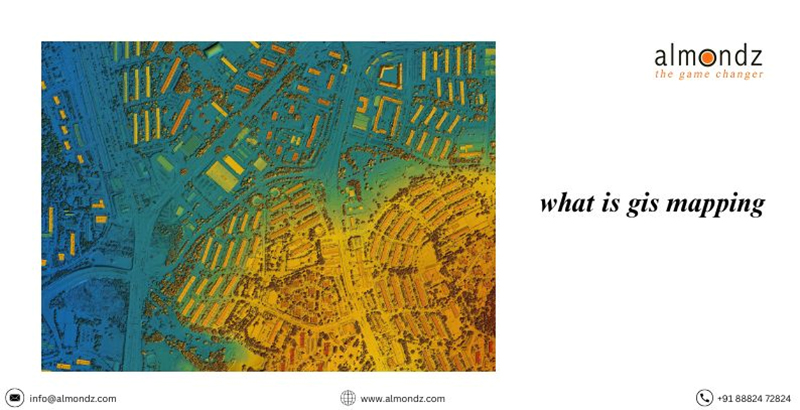
What is meant by GIS mapping?
At its foundation, GIS mapping is the analysis and interpretation of geographic data using technology. It includes combining hardware resources, software tools, and geographical data to develop thorough visualizations of geographic aspects.
The Value of GIS Mapping in Different Sectors
GIS mapping is a vital tool for supporting decision-making processes, which is used in everything from urban planning to environmental management. With its wide range of resource allocation and catastrophe response uses, it is a vital tool in today's data-driven world.
GIS Mapping's Development
Historical Context
Early advances in computer science and cartography date back to the middle of the 20th century, and this is where GIS mapping got its start. It has progressed from simple mapping methods to complex systems managing enormous datasets.
Developments in Technology
Technological developments have accelerated GIS mapping and made real-time data analysis and visualization possible. GPS, satellite photography, and sophisticated software have all been combined to create GIS mapping, a dynamic and effective tool.
Essential GIS Mapping Elements A. Spatial Data
Spatial data, such as geographic coordinates, topography, and other location-based information, are the foundation of GIS mapping. Reliable and accurate spatial data is the cornerstone of helpful mapping results.
Computer Tools
Various GIS software applications make data processing, visualization, and interpretation easier. These include proprietary software and open-source programs, each with unique features to meet the demands of different user bases.
Hardware specifications
To satisfy the computational demands of processing spatial data efficiently, the PCs, servers, and mobile devices supporting GIS mapping must meet certain specifications.
GIS Mapping Applications A. Urban Planning
Urban planners can use GIS mapping to help them make well-informed decisions on resource allocation, infrastructure development, and land use. It encourages sustainable urban growth and increases the effectiveness of city planning.
Management of the Environment
GIS mapping helps with biodiversity tracking, ecosystem monitoring, and natural resource management within environmental management. It makes it possible for researchers and decision-makers to address ecological issues to and Recovery from Disasters precisely
GIS mapping is essential to disaster management since it helps with post-disaster recovery planning, rescue coordination, and real-time information on affected areas.
Advantages of GIS Mapping A. Better Decision-Making Through geographical data analysis, GIS mapping provides decision-makers with insightful information. As a result, decision-making processes become more strategic and informed.
Improved Information Visualisation
GIS mapping makes complicated data more accessible to visualize and helps stakeholders better understand the links, patterns, and trends found in geographic data.
Enhanced Resource Allocation Efficiency
Organizations may maximize productivity and minimize waste by applying geographical insights to resource allocation. This is especially helpful for infrastructure construction, logistics, and agriculture industries.
Difficulties with GIS Mapping
Data Dependability and Accuracy
In GIS mapping, the dependability and correctness of spatial data provide constant difficulties. Maintaining high-quality data is essential to avoiding mistakes and inconsistencies in mapping results.
Financial Consequences
GIS mapping system implementation and upkeep can be expensive, particularly for smaller businesses. It's always challenging to strike a balance between functionality and financial limitations.
Problems with Integration
It can be challenging to integrate GIS mapping with current procedures and systems. Compatibility problems could occur, necessitating smooth integration techniques to guarantee uninterrupted operations.
Prospective Developments in GIS Mapping
Integration of Artificial Intelligence
An emerging trend is incorporating artificial intelligence (AI) into GIS mapping. Artificial intelligence (AI) algorithms improve data analysis capabilities by yielding more precise forecasts and insights.
GIS Solutions Led by the Cloud
Because they provide scalability, accessibility, and collaboration features, cloud-based GIS systems are becoming more and more popular. Operations are streamlined, and infrastructure expenses are decreased when geographical data is processed and stored in the cloud.
Applications of Augmented Reality
GIS mapping with augmented reality (AR) adds new capabilities for immersive and interactive geographical data experiences. Applications for AR can improve user comprehension and engagement.
Examples of Effective Implementation
Analyzing compelling GIS mapping implementation examples offers insightful information about tactics and best practices. Examples from real-world situations show the observable advantages and results attained.
Failures Teach Us Lessons
Examining situations in which GIS mapping projects encounter difficulties and setbacks aids in the identification of dangers and offers guidance for further efforts. Gaining insight from mistakes is essential to ongoing development.
How to Begin Using GIS Mapping
Selecting the Appropriate GIS Programme
Budgetary restrictions, user preferences, and specialized requirements all play a role in choosing the right GIS software. Functionality, usability, and scalability evaluation are critical to make an informed choice.
Education and Talent Acquisition
Gaining the abilities required for GIS mapping is essential. Certifications, online courses, and training programs can assist people and organizations in developing the skills needed to utilize GIS mapping fully.
GIS mapping is at the forefront of technical development and transforming our work with geographical data. Its uses in various industries highlight its importance for improving decision-making and handling complex problems. Integrating artificial intelligence (AI), cloud-based technologies, and augmented reality opens up new and exciting possibilities for GIS mapping as technology advances.
Related Blogs
Drone Survey Equipment: Revolutionizing Data Collection from Above